Monday, 21 September 2015

Mount Magnet to Meekatharra, Wiluna and a sneak peak onto the Canning Stock Route

September 4th
It doesn’t take long for the scenery to change from coastal to dusty outback. We drove further east and inland today through what is known as Australia’s Golden Outback as many of the towns were originally gold prospecting towns and the surrounding areas feature a host of old mining pits and relics from the wild Australian gold rush era. Gold mining still continues on a small scale today in a number of these areas.

There are loads of road trains and mining equipment vehicles out on these roads which can be very disconcerting to see especially when they are bearing down upon you. Today we had the biggest one we have seen yet coming towards us and you know you have to pull right over and stop when there are two escort vehicles preceding it saying wide load. We got off the road quick smart and the car shook as this truck passed us.


A stop for leg stretching at Meekatharra which is the largest centre in the Murchison region and is apparently a thriving mining, sheep and cattle district – you wouldn’t know it from stopping in town! So often we pull up to these country towns and wonder where all the people are and what the hell they do there. Got a good coffee and home-made lemon cheesecake and cherry ripe slice from a food van on the side of the main street though and ate it under a date palm. Didn’t realise it was a date palm to start with. We had been sitting there a while and the conversation went something like this:

Jo – “Aren’t people grubby – someone has left a whole lot of rotten dates all over the ground here. There is a bin just over there!!”

Stephen (looking up) “Hmmmm, I think the tree is the culprit. It’s a date palm sweetie!!”

Jo – “Oh…….”

Next stop was Wiluna and this is really the beginning of our next adventure and the start of some real remote travel. We needed some permits for the roads we are going to travel on for the next week or so and these hadn’t all come through yet. Taking advantage of mobile phone coverage and Internet access we made some calls and got our final permits sorted. To date, no-one has ever looked at the permits we have arranged for various parts of our journey but we always want to do the right thing. We fought with 20 billion flies while we had lunch and did some last restocking of minor groceries paying $7.50 for two avocados.

Two major and famous four wheel drive tracks begin from Wiluna – the Canning Stock Route and the Gunbarrel Highway. We are keen to do both of these tracks in their entirety at some stage however, on this trip we are content to get a sneak peak at the Canning and drive part of the Gunbarrel.


We left Wiluna and drove on the first part of the Canning Stock Route to see Well 1. The Canning runs from Wiluna to Halls Creek, is 1,850km long and is the longest historic stock route in the world.  In the early 1900’s, Alfred Canning, a surveyor, was appointed to survey a stock route that would cross the Great Sandy Desert, the Little Sandy Desert and the Gibson Desert. He needed to find significant water sources (enough for 800 head of cattle) a day’s walk apart where wells could be dug and enough good grazing land to sustain this number of cattle during the journey. Pretty big call but he was successful making the journey from Wiluna to Halls Creek in less than 6 months. Between 1908 and 1910, the construction of the stock route took place including the digging of 48 wells and water troughs. Just 7km from Wiluna is Well 1 and this is where we popped our head in to have a look at the ruins of this first wells.


A further 20km along the Canning and off the track a bit is North Pool where were stayed the night. A great spot near a water hole under fantastic trees – it was lovely sitting by the water that evening and again in the morning being visited by quite an array of birds coming down to get their daily drink.


Wreath flowers and Outback Gold

September 3rd
Today began our trek east and inland via the Wildflower Way. While we have constantly been seeing magnificent wildflowers throughout the trip we had been told that this part of the country was extra special and we could see some unusual types that we have yet to come across.

Stopped at Mullewa at the Tourist Info Centre and asked the guy there the question he is no doubt asked countless times a day “Where is the best place to see the wildflowers?” He was very good humoured about the whole thing and had a great spiel to get us going in the right direction.


We grabbed a coffee and a home-made mint slice at the local cafĂ© come general store – yummy and then started to do a wildflower walk just out of town but didn’t complete it as it was lots of what we have already seen – we have really been spoilt.


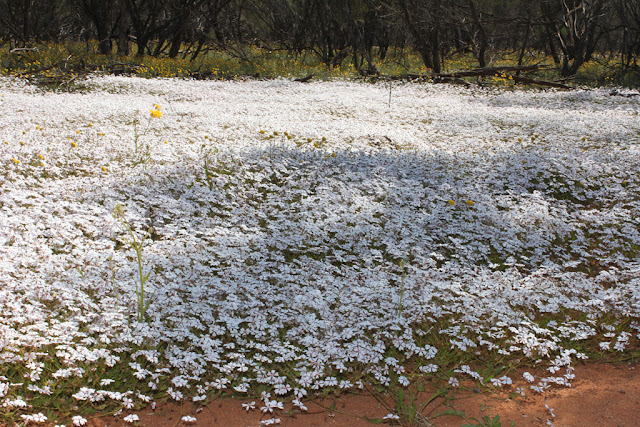
The big thing to see in this area are the wreath flowers so we followed the mud map the tourist info guy had given us and hoped to be impressed. We were!!! These flowers are like nothing we’ve seen before. On the way to the ‘secret’ wreath flower spot we also got to see those fields covered in blankets of pink, white and yellow flowers that I’d been dreaming about so all in all, a successful flower seeking mission.


We drove further inland from there and arrived late afternoon in Mount Magnet – not much there. Got a room at the Outback Gold hotel – a donga with three rooms which was actually quite pleasant and breakfast was even included. Had dinner at the Commercial Hotel – love outback pub grub – sensational steak and damn good fish but couldn’t say the same for the wine! 


Really ancient stuff - stromatolites and Kalbarri National Park

September 1st & 2nd
Up early and headed to Hamelin Pool to see the stromatolites. Here is your Science lesson from Stephen the Science teacher who was in heaven at this spot……..Stromatolites are cool and not just in a science, nerdy way but truly amazing! Firstly, they are amongst some of the earliest organisms to have existed on earth, estimated to have been around about 3.5 billion years ago. When you consider that the earth is only estimated to be 4.5 billion years old and spent a significant part of the first billion years as a blob of molten rock, this means that this life on earth developed pretty early in the piece. Secondly, we think of oxygen as some sort of pure, clean giver of life but the reality is, earth’s early atmosphere was pretty much void of oxygen. In fact, the oxygen that humans and all other animals depend on was actually produced by the same micro-organisms that produced stromatolites. So think about that - the oxygen we breathe is the waste product of these ancient organisms.  Here ends the Science lesson.


From here we continued south along the North West Coastal Rd to Kalbarri National Park (so glad we bought the $44 WA Parks Pass – it has been real value for money given the number of NPs we have visited). Again, there were loads of amazing wildflowers. Different ones to what we have seen to date. The most striking ones here are long, wispy silver bushes interspersed with numerous yellow flowers. With the wind blowing the silver ones look like a shimmering sea.


Kalbarri NP is one of WA’s most well-known parks. It surrounds the lower reaches of the Murchison River which has cut an 80km gorge through the red and white banded 400 million year old sandstone of the area creating a number of wonderful formations. Nature is incredible in the way it can carve the landscape. The Park also includes a coastal section showcasing the soaring cliffs (some over 100m high) along the Indian Ocean.


Within the river section of Kalbarri NP there are two specific areas to visit – the Z Bend and The Loop plus a number of lookouts. On the way into the Park we stood atop the Ross Graham Lookout and got a feel for the beauty of the place. We then drove to The Loop with its natural rock arch ‘Nature’s Window’, which frames the upstream view of the Murchison with red rock. 


Not far away, the Z Bend provides phenomenal views of the river 150m below and is so named as at that point the river snakes in a Z through the valley.


While these examples of natural beauty are quite spectacular, the thing that struck us most in Kalbarri NP were the ancient tracks of the Eurypterid - a giant 2m long scorpion like creature. Around 400 million years ago, life was venturing out of the oceans for the first time. Some of these early creatures walked across the mud flats of this area, preserving their footprints for eternity. And there was no fanfare – just a sign telling you a little bit about it. The tracks were discovered in 1995 by Australian palaeontologist Dr Ken McNamara and Briton Nigel Trewin. The discovery of the tracks upset classic evolutionary theory that plants and herbivores were earth’s first colonisers. We saw a number of these footprints/tracks here – what an amazing and special thing to see the footsteps of some of the first creatures that walked the earth.


That night we stayed in Kalbarri the town – another coastal holiday destination. It reminded us of The Entrance on NSW Central Coast before it got as commercial as it is now. It was REALLY cold in Kalbarri and we were reluctant to leave our hotel room but we braved the cold for dinner out which is always a treat when we’ve been camping for a while and cooking our own meals.

I went for a run the next morning – sunny but freezing. From one extreme to the other!! A few days ago we were snorkelling and swimming and trying to stay out of the sun and this morning it was six degrees in Kalbarri. Before heading off we watched the pelicans being fed on the foreshore and then drove back into Kalbarri NP – the coastal section this time. We weren’t too keen to get out of the car and walk in the freezing wind on the cliffs but we did manage a few more lookouts to see things such as Island Rock (a sea stack), the Natural Bridge and Mushroom Rock, cliff faces (Red Bluff) and some whales from a distance.


At Port Gregory, about 65km south of Kalbarri, we saw a bizarre pink lake on the side of the road. There are a number of pink lakes in WA. The pink colour is a result of green alga bacteria (Dunaliella salina) becoming trapped in the salt granules of the lakes. Once the lake water reaches a salinity level greater than that of sea water and the temperature is high enough and adequate light conditions are provided, the alga begins to accumulate the red pigment beta carotene. It was really a bubble gum pink colour – very different.


From this interesting side stop, we continued on to our most southerly destination in WA this trip – Geraldton. This would be our last coastal stop before heading inland and east towards the other coast. We stayed in an apartment here on the beach but it was way too cold for swimming. This was purely a provision shopping and washing stop. We even got take away Indian for dinner from the #1 restaurant in all of Geraldton (according to Trip Advisor) and we must agree it was pretty darn good food. 

Saturday, 12 September 2015

The most westerly point of Australia’s mainland and other cool stuff

August 30th & 31st
We had heard nothing about this area so our decision to visit Steep Point was a rather whimsical one, based purely on the desire to be able to say we stood on the most westerly point of mainland Australia having the most northerly and the most easterly already under our belts. Regardless of our reason to visit, it quickly became apparent that this was an excellent decision as this was one of the most magnificent spots we had seen on our adventure.

We drove that morning from Wooramel Station to the Useless Loop Rd (great name!!). There was 100km of pretty decent dirt road then 30km of amazing, challenging and fun driving through sand dunes, past huge sand blows that made us think we were in the Sahara Desert, turquoise blue water from a distance and then up close as the track wound its way along the water front taking us to Shelter Bay to camp for the night. This was an idyllic – right on the water with views to Dirk Hartog Island (remember your primary school history lessons). Spent the afternoon doing a bit of fishing, a bit of swimming and a bit of walking on the beach and rocks. We fell asleep with the sound of the waves crashing on the shore.


Next morning – bit more fishing and swimming then off to stand on the most westerly point of Australia’s mainland. At Steep Point was the obligatory ‘Most westerly point….’ sign but what we didn’t expect to find in front of the sign was a photo pole (complete with instructions) strategically positioned to ensure no-one missed out on their photo opportunity once they had driven all this way! We stood up there for ages being buffeted by the wind and watching a few whales cavorting in the distance. It was a grey day which kind of seemed appropriate weather to be in this rugged place. It was a huge swell and standing there watching the enormous waves crash against the 30m cliffs was really quite a spectacle.


We dragged ourselves away from Steep Point and drove down the west coast of this point of land. Our breath was constantly taken away by the rugged and amazing coastline and the stark contrast between the white foam of the crashing waves, the redness of the sheer cliffs and the green and yellow of the bushes and wildflowers just back from the cliffs.


One of the features of this coastline is a series of blow holes. Given the size of the swell on the day we were there, the blow holes put on a spectacular display. With each new wave that pounded the coast, sea spray shot forth from these holes with a force and noise that was awesome and a little bit scary at the same time.


We completed the coastal circuit, got back onto the Useless Loop Rd and our accommodation for the night was at Hamelin Bay Station Stay (www.hamelinstationstay.com.au). The Station was a working station for many years and the previous owners had a vision to provide travellers with a place to stop and rest and experience a little of what it was like to live on a working sheep station. They oversaw the restoration of the original shearer’s quarters and ensured that all new buildings were built of local rock and corrugated iron in keeping with the aesthetics of the other station buildings. The Station has recently been bought by a non-profit, private conservation group called Bush Heritage Australia that protects millions of hectares of ecologically important land (www.bushheritage.org.au). Hamelin Station is an area of outstanding conservation value and Bush Heritage’s over-arching aim for the Station is to protect the natural biodiversity and its underlying ecological value.


Ran into a number of people we had crossed paths with before on this trip. Interesting how people pop up over again – guess everyone is doing the tourist trail and while we try to avoid the road more travelled, in some parts you have no choice but to stay in spots that everyone else does.


Afternoon walk to the lake for a spot of bird watching and also explored the old shearers shed on site. We stayed tonight in the refurbished Shearer’s quarters.